| Lightrail.nl We truly take pride in providing high quality public transport |
||
| Archive | ||
Lightrail.nl will continue to make part of our early work (1997-2015) available. But these pages are no longer updated.
www.lightrail.nl/TramTrain
www.lightrail.nl/toyama
www.lightrail.nl/studytours
http://www.lightrail.nl/NL
|
Light
Rail Atlas
When Light Rail Atlas entered the internet in 1998 basically the idea was to develop a showcase of examples and best practices of existing, new or proposed light rail systems. We presumed (and still do) that maps represent essential information and knowledge regarding these systems and to some extend the showcase was conceived as a real atlas, which explains the name of this website.
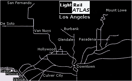
Example: line-based map of the historic 'Pacific Electric' of Greater Los Angeles. Once upon a time the PE operated a 1.164 miles network. However, the last survivor line closed in 1961. All lines are marked as white lines. We made this map as part of our ongoing study of the Los Angeles' urban system. The map is based on the famous research of Reyner Banham, published in his book 'Los Angeles. The Architecture of Four Ecologies' (1971).
The
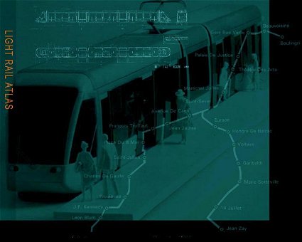
old background, designed in 1998 by Lex Koetzier, embellished the
website until December 2006. The sober, dark-green background
of 1998 reflects the meaning of light rail developments at that time
in France. Two French projects are depicted. The first one is the
tram project of Rouen, opened in 1994. The map of this network is
clearly visible. The terminus Boulingri at the north side of the
central city is used by the system's two lines which share an alignment
through the city centre, party in tunnel, to the stop Saint-Sever.
From here each line continues to respectively the terminus of Leon
Blum and Jean Zay. The model of a tram, serving a platform and its
passengers belongs also to the project of Rouen. | |
|
Copyright & Design: RVDB
- Urban Planning, Amsterdam, Netherlands, 1997 - 2015
|
||


