CASE STUDY...
LRA 2001-2004
Portland (Oregon):
Transport Oriented Development in Cascadia
Light Rail Atlas/RVDB (Amsterdam, Netherlands) in co-operation with OTAK (Lake Oswego, OR, USA).
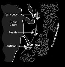
(C) Light Rail Atlas / Rob van der Bijl, 1998-2004.Portland (OR), Seattle (WA) and Vancouver (BC) are the three big cities in the Northwest of America. The smaller, number 4 city of Tacoma (WA) however has the newest transit system, opened in August 2003.
This Case Study considers the regional public transport system of Portland (OR). Urban development can be guided with the help of high-quality public transport rail-infrastructure. Portland's Light Rail MAX is a success. This superb system supports regional and urban planning, while both Portland Streetcar and MAX serve as tools of urban renewal.
Cascadia cherishes its global position, strategically situated in the Pacific Northwest, close to Asia, but also close to centres in Canada and the U.S. Cascadia represents one of the largest regional economies worldwide.
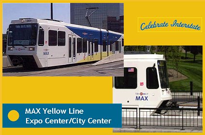
May 1, 2004 - Celebrate Interstate
MAX Yellow Line is running. The $350 million project marks another big step for Portland's region. The 5.8-mile line running through North Portland between the Rose Quarter and the Portland Expo Center uses an alignment along North Interstate Avenue, a former state highway. 'Interstate' as the line is also named, is able to carry 13,900 passengers a day. According to local spokesmen "the new line aims to bolster economic development and housing opportunities in the downtrodden corridor."
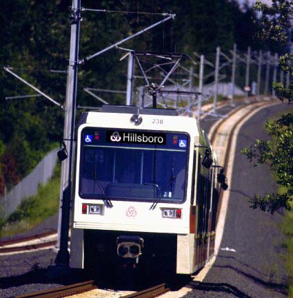
Photo: (C) Light Rail Atlas/OTAK
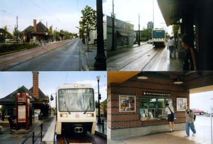
Portland-Hillsboro, summer 1998In the Portland region, in the American state Oregon, a new regional public transport system has been taken into development in the early eighties. This system is regarded as the foundation of urban planning within the region. Since the Americans virtually have had to reconstruct something out of nothing, the Portland region represents an excellent case study to find out how urban development can be guided with the help of high-quality public transport rail-infrastructure.
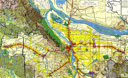
The city of Portland constitutes the core of the region. This central conurbation of 380.000 inhabitants though is accompanied by three cities. To the East, at a distance of about 30 kilometres is Gresham, and about equally far to the west is Hillsboro. At a relative short distance (15 kilometres) to the north is the city of Vancouver in the state Washington which is separated from Oregon by the Columbia river. South of Portland one finds cities such as Wilsonville, Lake Oswego and Oregon City. Together with smaller towns in the central part of the region the Portland conurbation form a cross-shaped urban area with a span of more than 60 kilometres, and 1.9 million inhabitants.
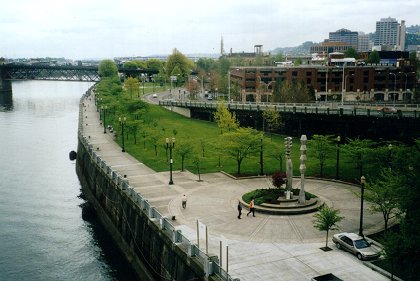
New park along the river in Portland
Photo: (C) Light Rail Atlas/Rob van der Bijl, May 2, 2001During the seventies it became apparent that an uncontrollable increase of motor traffic causes great problems. The course was changed. Symbolic was the decision to demolish a motorway off the centre of Portland along the river Willamette, in order to connect that centre to the river through a new park. Plans to construct a transit-system also date from that time: Metropolitan Area Express (MAX).
Network
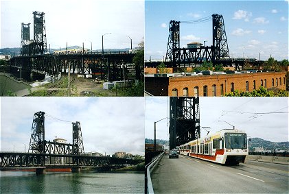
The first line of this system was opened in 1986. This Light Rail-line runs through the centre via an S-shaped loop and then branches off in eastern direction. Over the famous Steel Bridge this line shares the lane with the motor traffic. It runs, on reserved track, to Gresham over Lloyd Center and Gateway
The famous 'Steel Bridge'
Photo: (C) Light Rail Atlas/Rob van der Bijl, Portland, May 2, 2001The introduction of this line is combined with a restructuring of the centre. This public space is thoroughly renovated and revalued. Street profiles for motor traffic are narrowed and the number of shopping facilities and offices is extended. Yet at the same time the number of parking places in the centre is reduced. Along the line the new sites are developed, which will serve as urban and regional nodes. In addition to the centre also within these regional nodes new facilities are being created. The authorities are taking the lead in this matter for instance by locating a new town hall or police station near the main Light Rail stop within a node.
A great number of stops will carry out the function of 'transit centre'. These are nodes where people can transfer to bus lines. Furthermore there are P&R-facilities at these and other stops, mostly in the form of parking places for about 200 to 300 cars.
Additionally a 'growth boundary' is established around the region, within which the urbanization must remain henceforth. The idea of such a boundary doesn't arise from intentions of a compact city for that matter. Especially the farmers on the edge of the region have thought it necessary to protect the countryside against further urbanization. The institution of the 'un-American' border is nevertheless a huge advantage to the development of the new rail infrastructure. It constrains the urbanization within the region, and with that also within the reach of the Light Rail stations.
Some flexibility has been let into the enforcement of the boundary. At the boundary reserve areas have been assigned which under certain conditions can still be developed. To start such a development an extensive investigation however is necessary, with which all sorts of prescribed matters have to be proved. In practice this doesn't appear to be so easy.
'Node' Hillsboro
Photo: ( C) Light Rail Atlas/Rob van der Bijl
Portland/Hillsboro, August 10, 2000In August 1998 the Western line to Hillsboro was opened. The line is developed through with the Eastern line and has been constructed according to the same principle. Some of the P&R-facilities are bigger though (600 places, with an option of 1200). And even more explicitly, it has been tried to link centres of eminities and housing areas to stations of the railway line.
As early as the year 2000, merely two years after the opening, success is evident, not only regarding the by now proven transport value, but also concerning the effect upon the urban planning. The revival of the centre of Hillsboro is striking. And also the until recently shabby western part of the centre of Portland has been noticeably restored.
The success of the Light Rail-line has to do with the fact that the customer is being offered a combination of a fast transportation between the different regional nodes on the one hand and a fine opening up of those nodes on the other hand. Hillsboro is such a node where MAX runs through the street as a tram and serves the node with no less than three stops. This way, from Portland-Centre a fast connection without transfers arises with the most important sites of Hillsboro within the region.
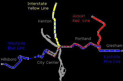
Since September 2001 a line to the airport operates as a Northern branch near Gateway. Another Northern line, in the direction of Vancouver (WA), called 'Yellow Line' or 'Interstate Line' has been opened in May 2004.
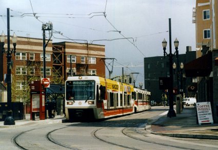
Portland centre
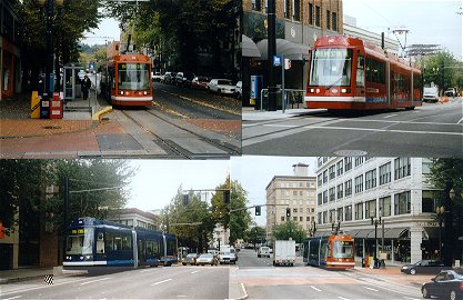
Photo: (C) Light Rail Atlas/Rob van der Bijl, May 1, 2001MAX uses Light Rail Vehicles of a type that has been deducted from German 'Stadtbahn' equipment (2.65 m. wide, with high floors). A second series of LRV's, that has been taken on at the opening of the Western line, largely has low floors that allow an entrance at ground level.
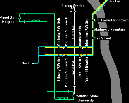
In the centre, square to the MAX line, a new independent city tram line (Portland Streetcar) has been opened almost at the same time as the airport line. The 3.8 kilometres long line connects the university through an alignment on the Western side of the city centre with a new housing estate Northwest of the centre.
Green = Streetcar Yellow/Blue = MAX White = Bus Grey = riverThe streetcar crosses the urban line of the regional MAX line, just like the bus corridor on the Eastern side of the centre. The line is operated using trams that are constructed by the Skoda company in the Czech Republic.
The 'streetcar' line in the university district and the centre
Photo: (C) Light Rail Atlas/Rob van der Bijl
Portland, May 3, 2001 / October 12, 2001Portland Streetcar is an entirely local business. Construction and operation are financed by the city (using parking fees). Local entrepreneurs along the tram line have contributed to the costs of construction through a special tax. In preparation is an extension of the line, from the university towards a Southern part of the city, near the river.
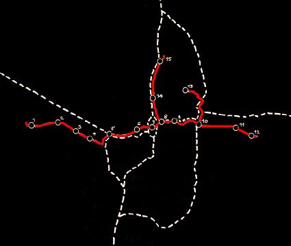
Red = MAX Light Rail O = node White = Motorway
Nodes Portland
Map: (C) Light Rail Atlas/RVDB, Amsterdam 2000-2002Setting aside further plans for the future the case study shows that the current system, including the already established and planned extensions, comprises a total of 15 urban nodes (nodes beyond the range of MAX are left aside here). By and large it involves intermodal nodes, that means places where a number of modalities come together; in those places Light Rail crosses bus and car traffic. A node includes one or more MAX-stations. Although not all of the stops are located within a node, most of them are. Here is a list of all served by MAX nodes:
Hillsboro (1); public/economy/residential/transfer
Portland Light Rail Network scenario of the 'Base Case'
Including the built East-West line (Gresham-Portland-Hillsboro)From node 4 (Beaverton) a 'commuter rail' has been planned. It involves "diesel multiple units" (DMU's) running over existing rails into the region, to Wilsonville (Node 16, not on the map).
MAX is a success, nevertheless the project also provides a clear example of things that can go wrong. In other words, transport oriented development and urban planning by means of high-quality rail infrastructure is possible, yet also bound by a number of restrictions.
For one thing it turns out that besides the desired nodes along the MAX-line also elsewhere big sites are still being developed. Generally these sites are relatively cheap and easy to develop; for instance the costs of purchasing land are lower, clearing land is easier and/or the spatial and functional conditions are less complicated. This has to do with two other factors that complicate transport oriented development. The construction industry represents such a factor. Especially when house-building sites are involved, in Oregon this line of business is particularly interested in developing large numbers of houses. For many property developers the smaller sites (for example near MAX-stations) are commercially and organizationally less interesting.
The role of the local authorities is a factor too. Also, in Portland regional administration is chiefly a matter of co-operating. The municipalities preserve their autonomy. When such a municipality (Beaverton for example) still decides to develop a site elsewhere in stead of along MAX this cannot be stopped at a regional level.
The municipality of Beaverton (as the only large municipality for that matter) is still strongly holding on to the car/motor infrastructure as a foundation for urban development. That is why in spite of the existence of MAX a new service centre is situated along an important motorway. Most likely this has lead to the stagnation of the planned centre along the MAX-line in the same municipality (Beaverton Central). Well into the year 2001 this centre lay about useless only halfway finished as a modern ruin.
Especially in the U.S. the power of individual land owners cannot be overestimated enough. This can frustrate the development of a node along the MAX-line considerably. For instance the Intel company is making sure that a node at a potentially important station in Hillsboro has as yet only been filled up halfway. The other half happens to belong to Intel and remains allocated for future company use. To a certain extent all of the above mentioned issues have to do with probably the main restraining factor in using infrastructure and transport oriented development, that is the absence of a regional land policy and the accompanying set of instruments. Certainly, according to American standards the regional administration and the regional area policy in Portland is fairly elaborated. Nevertheless this case shows that both local authorities and private persons involved still want to develop the wrong sites. The authorities though lack the possibilities (and the will) to break the power of the private landowners. At the same time those authorities occasionally choose easy, car-orientated sites.
Photo: (C) Light Rail Atlas/OTAK
Hillsboro, terminus, summer 1998
Nevertheless MAX is obviously successful. Notably the increase in value of real estate within the different nodes prove to be an effective means of urban planning. A great deal of investigation (into) the price-fixing of houses has been conducted. The tenor of this investigation is clear: houses near MAX-stations increase in value, in the order of 10%. A distance of 500 metres from a station for instance can be worth an increase in value of 10,6%.
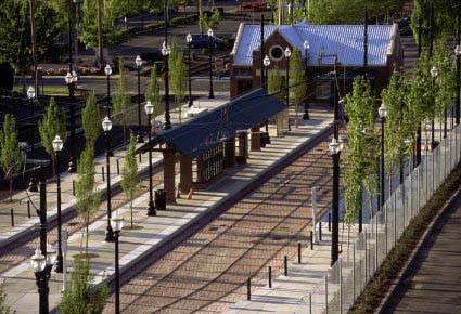
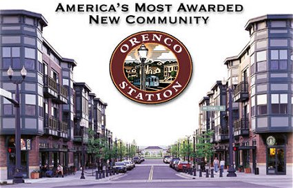
Orenco StationProgramming high density development of the districts around the stations in Portland also has a value-increasing effect. In general it turns out that the so-called "MAX factor", i.e. the presence of Light Rail, plays a key role in decisions about establishments and investments. In this respect issues are mentioned such as:
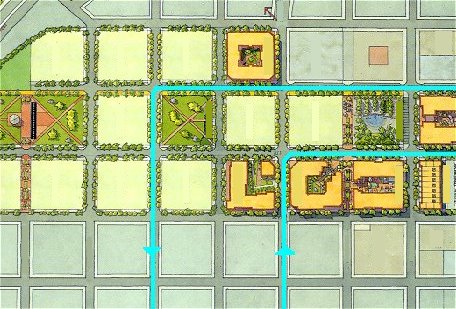
Urban Plan: Hoyt Street YardsPortland Streetcar (costs of infrastructure and equipment: 56.9 million dollars) has first and foremost been constructed to support the spatial and economical development of the city. The transport value is of minor importance. Moreover a great part of the line runs through the 'fare free zone', so that the revenues from ticket sales obviously don't matter that much.
On the site of an old railway yard Northwest of the centre a new housing estate is realized. The construction of Hoyt Street Yards, the name of the housing district, is still well under way (situation of early 2002), but the tram line has already been opened. The redevelopment of this city district is of big importance to the (future) local economy. The houses attract a public with great purchasing power into the city; a number of facilities can be created. Therefore good restaurants can be found in this district of Portland.
It is still much too early to conduct empirical investigation into economical and spatial effects. Yet this project is pre-eminently a good opportunity to demonstrate effects upon real-estate prices and employment in the near future (from the year 2003 onwards).
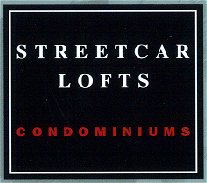
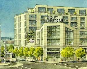
Already it is evident that the tram will increase the value of the new apartments in Hoyt Street Yards. 'Streetcar' is a solid sales argument. By the end of 2001 for example a block of so-called 'condominiums' has been sold under the name of 'Streetcar Lofts'!
Hoyt Street Yards: 'Streetcar Lofts'
A comparison with the European situation reveals great contrasts to the American situation.
As for the density and grain size Portland is only somewhat smaller than the Amsterdam region for example, but much smaller than the metropolitan area of Paris, Munich, or Madrid, not to mention Tokyo. The distances are very well comparable. The public transport systems on the other hand differ enormously.
Basically the new regional system of Portland has too many tasks to carry out. Besides as a regional public transport system it is used for travelling over longer distances (up to about 60 kilometres), and, please note, also for the opening up of the local area. It's like that because apart from the 'Streetcar' and a few local bus lines no other means of public transport is offered.
The advantage compared to European slow-train-services nonetheless is made very clear by this case study. Where in many German situations an 'S-Bahn' would run from Hillsboro over Portland-centre to Gresham, MAX offers a quick connecting service not only between the three main cities, but also between all of the other important centres. Anyway this shows that the network of Portland is very well comparable to the regional Light Rail system of Karlsruhe or Saarbrücken. Another strong point of MAX is the offered opening up by means of local Light Rail stops of the three main centres. In countries like the Netherlands, Belgium, France and Spain slow-train-services hardly contribute to the opening up of such centres (concerning the traffic situation and the urban development that is even nearly impossible).
These two points distinguish the regional system of Portland from those of somewhat larger regions in Europe. That's Portland's strength, and exactly that makes it possible (to a certain extent of course) to use the public transport rail-system as a driving force behind transport oriented development which is focused on urban nodes in the region.